WebGIS
The LIFE+ project Making Good Natura provides free simple access to the wealth of cartographic information it developed. It is a tool for communicating and sharing geospatial data with other users. Geographic or alphanumerical data can be found and images downloaded from the same interface using the search tool of WebGIS and a simple browser. The WebGIS system is a useful platform for local government, providing much environmental information about administrative areas, and also for citizens, providing them with details about their area.
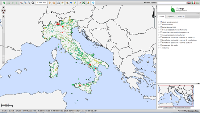
The platform shows:
How to view one or more themes
How to obtain information on visualised areas
How to search by predefined questions
How to save and print images
Definitions used for the WebGIS:
Download the WebGIS Manual
Open the WebGIS